Places
Mojácar and Cabo de Gata: A Base for the Park's North-East Coast
Mojácar is not part of Cabo de Gata. It is a separate town on the Almería coast, just north of the natural park’s north-east corner: a white hill village, Mojácar Pueblo, with a long strip of beaches and hotels, Mojácar Playa, below it. Mojácar’s own tourism office says its coastline ends at Sopalmo, just a few kilometres from the beginning of the Cabo de Gata-Níjar Natural Park and the border with Carboneras.
That makes Mojácar a sensible base for the park’s north-eastern side — Carboneras, Los Muertos beach, Agua Amarga and the boat trips along that stretch of coast — if you want a bigger resort with lifeguarded beaches and plenty of beds and restaurants. It is a poor base for the far side of the park: San José, Genoveses, Mónsul, the salt flats and the lighthouse are a long drive away. This article explains what Mojácar is like, how it connects to the park, and how to plan days into Cabo de Gata from it.
Is Mojácar part of Cabo de Gata?
No. The park has 37,500 ha of land and 12,012 ha of sea spread across three municipalities: Almería, Carboneras and Níjar. Mojácar is not one of them.
The boundary runs south of Mojácar’s coast. The province’s tourist board publishes a walking route from the north of Carboneras, past El Algarrobico beach, to Sopalmo, and describes it as following the park’s north-eastern land boundary. Sopalmo, the outlying hamlet at the southern end of Mojácar’s coast, is where Mojácar stops.
In practice the coast from north to south goes like this:
- Mojácar — the resort, with hotels, apartments and beaches with services.
- Sopalmo and the southern coves — the quiet end of Mojácar’s coast, a few kilometres short of the park.
- Carboneras — the next town south, where the park begins and the boat trips leave.
- Los Muertos — the famous beach between Carboneras and Agua Amarga.
- Agua Amarga — the first of the park’s villages coming from the north.
Mojácar Pueblo: the white village
The old village sits on a hill above the coast. Mojácar Pueblo stands 175 metres above sea level, beside a spring, in the lower foothills of the Sierra Cabrera. Seen from the road below, the white houses seem to wind around the hill and cling to it. The roofs are flat or terraced, which makes the houses look like a pile of white cubes, and inside the village the streets are narrow, steep and full of flowerpots.
The town hall’s description ends with a reminder that the old town is recognised as one of the most beautiful villages in Spain. It lives up to it, especially early in the morning and in the evening, when the light on the white walls softens and the viewpoints look out over the coast in one direction and the mountains in the other.
Where people actually stay
Andalusia’s tourism board is candid about how the town works: most visitors sleep in the hotels and apartments of Mojácar Playa, down on the coast, and drive or ride up to the village to walk its streets and have dinner. The town hall puts the sea two kilometres downstream of the old village, so the two are a short drive apart but a real uphill walk.
The mojaquera
Walk into the village and you will see the same figure on signs and statues: a woman with her head covered by a scarf and a water jar on her head. Andalusia’s tourism board calls this mojaquera the town’s main symbol. She recalls the washerwomen who, until the middle of the last century, did their washing at the Fuente de Mojácar, the fountain at the foot of the village.
A short history
Mojácar’s past explains both its looks and its festivals.
- Early settlement. The town hall dates the first traces of people in Mojácar to the Neolithic.
- Mojácar la Vieja. From the sixth or seventh century AD until the middle of the thirteenth century, the town stood on another site, Mojácar la Vieja, first as a Visigoth and then as a Muslim settlement. The archaeological site is on a hill above the plain of the Aguas river; the remains you can see date from the early Islamic period, and a large cistern crowns the top.
- The surrender. In 1488 the mayors of the whole area surrendered to the Catholic Monarchs, except the mayor of Mojácar. Captain Garcilaso de la Vega was sent to the fountain to talk to Alabez, Mojácar’s mayor, who told him his people had lived in Spain for more than 600 years and asked to be treated as brothers, not enemies. The surrender that followed was negotiated rather than fought.
- Silver and emigration. In the middle of the nineteenth century a rich seam of silver was found in the nearby Sierra Almagrera, bringing money and people. The mines closed at the start of the Second Republic, and many people left.
- Artists and visitors. During the 1950s the Almería painter Jesús de Perceval founded the Indaliano Movement, which had its roots and aesthetic capital in Mojácar. Tourism followed. Andalusia’s tourism board notes that Mojácar is especially popular with British visitors, many of whom now spend the winter there.
The Indalo
You will see the Indalo all over Mojácar and the rest of the province. It is a simple stick figure holding an arc over its head, which some read as a hunter with a rainbow.
Its story has two strands, and the town hall’s own page tells both:
- The house charm. Long before it was a logo, figures called “muñecos mojaqueros”, painted in red clay, were a traditional way of protecting the houses and farmhouses of the Sierra de Mojácar.
- The cave painting. Schematic prehistoric paintings in the Los Letreros cave at Vélez Blanco include a figure that may be the Indalo’s origin.
- The name. The name comes from Indalecio, a bishop said to have reached Spain through Almería.
- The revival. Perceval and the Indaliano painters took up the symbol in the 1950s, basing its meaning on the figures already painted in Mojácar.
Whatever its origin, the meaning is not in dispute: the Indalo stands for a higher power that protects places and people from danger.
Mojácar Playa and the beaches
Mojácar’s 17 kilometres of coast run from Marina de la Torre, on the border with Garrucha, south to the Granatilla dry riverbed at Sopalmo. It is two coasts in one.
The resort beaches
The resort beaches are the easy ones. The town hall lists Marina de la Torre, El Cantal, Cueva del Lobo, Las Ventanicas and Venta del Bancal among the fine sandy family beaches with all services, some of them with EU Blue Flags.
Lifeguards make these beaches the safest choice for children. For the 2026 bathing season, the town hall’s timetable had lifeguards on seven beaches from 1 July to 31 August, from 11:00 to 19:00 and until 20:00 at weekends, with a smaller service on a few beaches at weekends in spring and autumn. The dates change every year, so check the town hall’s beach page before you go.
If you travel with a dog, Del Perulejo beach is signed as dog-friendly. That matters, because the rules inside the park are stricter in summer: during the bathing season, from 1 June to 30 September, domestic animals may not enter bathing waters and bathing areas.
The quiet south
South of the resort, along the coast road towards Carboneras, the beaches change character. Macenas beach, on the road to Carboneras, is quiet and takes its name from a defence tower beside the sea, built in the reign of Carlos III under a coastal defence project of 1765.
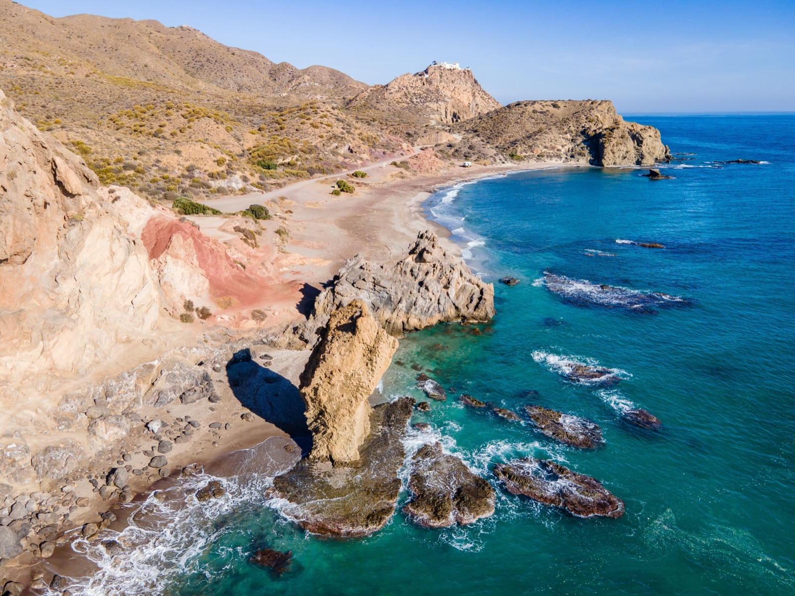
Beyond it, the coves of Mojácar’s southern zone — Bordenares, El Lance and Cala Granatilla among them — are unspoilt and protected for naturism. The town hall describes them as immaculate, with abundant marine life: a foretaste of Cabo de Gata.
Moors and Christians
Mojácar’s biggest festival is Moors and Christians, held every year in June. The town divides into guilds called cábilas that parade through the streets dressed as Arab or Christian soldiers and captains, with musicians, horsemen and dancers. The festival remembers the negotiated surrender of 1488 rather than a battle; as the town hall puts it, there were no winners or losers. Dates move from year to year, so check with the tourist office if you want to see it.
Getting to Mojácar
- From Almería. Mojácar is 90 km, about 55 minutes by road, from Almería. From Almería airport, a bus runs to the city, and ALSA runs a coach service from Almería to Mojácar.
- From Murcia. Murcia airport is about 135 km from Mojácar, which can be a useful alternative for flights.
- By road. Mojácar lies just off the E-15 motorway, the same road that serves the park. See our guide to getting to Cabo de Gata for the park side.
For day trips into the park, a car is close to essential. Buses exist, as explained below, but they are infrequent and do not serve the park’s beaches.
From Mojácar into the park
The coast road
The AL-5107 links Mojácar and Garrucha directly with Carboneras, running largely parallel to the coast. It is the natural way south: past the resort, past Macenas and the naturist coves, through the hills around Sopalmo, and down into Carboneras.
In Carboneras, the park begins. From there the AL-5106 continues along the coast to Agua Amarga, through what Carboneras’ tourism office calls the most natural areas of the park. Los Muertos lies on this stretch, between Carboneras and Agua Amarga.
By bus
Without a car, it is harder. An Autocares Baraza line links Carboneras with Mojácar, Garrucha, Vera and Villaricos, but Carboneras’ own tourism office warns that it runs with limited frequency. From Carboneras, Autocares Frahermar runs a regular bus to Almería that takes about an hour. For Los Muertos without a car, the summer shuttle from Carboneras is the way in; for the coves, a boat trip.
Day plan one: Los Muertos and Agua Amarga
This is the classic day from Mojácar, and it needs an early start in summer.
Morning: Los Muertos
Drive south on the coast road through Carboneras to the Los Muertos car park. Stop first at the Mirador de Los Muertos, the viewpoint that shows the whole sweep of the beach before you walk down.
The practical details matter here:
- Parking. In summer the car park charges €6 for cars, €3 for mopeds, €4 for motorbikes and €10 for vans, motorhomes and buses, from 09:00 to 21:00, and spaces are limited.
- The shuttle. From early July a shuttle bus runs from Carboneras town to Los Muertos.
- The walk. Three paths lead down: one from the information point, about 700 metres with a steep drop; one from the end of the car park, 100 metres shorter but much steeper; and old, uneven stone steps near the viewpoint. The descent is not advisable for children, older people or anyone with reduced mobility.
- The beach. Los Muertos has no services, the shore shelves steeply, and swimming is dangerous in a strong levante, the east wind.
Take water, food and shade, and remember that the climb back up comes in the heat of the day. Our guide to Cabo de Gata’s beaches has more on Los Muertos and its neighbours.
Afternoon: Agua Amarga
Continue south on the AL-5106 to Agua Amarga, past the tower and lighthouse on Mesa Roldán. Mesa Roldán’s flat top is a fossil coral reef that grew on an old volcanic dome about 6 million years ago, when it was under water.
Agua Amarga is a quiet fishing village of fewer than 300 inhabitants, with a sandy beach right in front of the houses. On the hill above it are the ruins of an old loading dock where iron ore from the Lucainena de las Torres mines was loaded onto ships. The railway’s pier was finished in 1895, and the dock worked until 1942, when the last ore ship, the Bartolo, sailed.
If you have energy left, two wild coves lie close by. Cala de Enmedio, reached only on foot, has 150 metres of golden sand between two sea-eroded limestone formations; Cala del Plomo is another rugged cove on the way to Las Negras. Our guide to the park’s villages covers Agua Amarga in more detail.
Day plan two: the coves by boat from Carboneras
Much of this coast is cliff, and the best way to see it is from the water. Carboneras, the first town south of Mojácar, is where the boat trips on this stretch of coast leave.
- Boat to five coves from Carboneras. Two hours in a small-group boat past Los Muertos beach, the fossil reef of Mesa Roldán and Agua Amarga, anchoring at Cala de Enmedio for a swim; snorkel gear is included, and there is a refund if the sea is too rough.
- Sailing to Los Muertos beach. A family-friendly sailboat from Carboneras to Los Muertos and Agua Amarga, with a snorkelling stop in a cove, over about 3 hours.
Current rules prohibit landing boat passengers directly on Los Muertos beach, so you will see it from the water. Strong east winds cancel trips, so keep a spare day if you can. The tours page lists these trips with live prices.
Day plan three: deeper into the park
Beyond Agua Amarga the park villages continue south, and each is a reasonable day from Mojácar if you do not mind the driving.
- Las Negras and Cala San Pedro. Boats from Las Negras beach reach Cala San Pedro in 10 to 15 minutes; on foot it is a walk of about two hours from the village. Cala San Pedro has a natural freshwater spring and a small community that lives there all year.
- The coastal walk. The signed trail from Las Negras via Cala del Plomo to Agua Amarga is 11.1 km one way, takes about 4h 30m and is graded medium to high. Leave a car at each end or arrange a lift back.
- Rodalquilar. An old gold-mining village in a volcanic valley, with the park’s administrative centre and a botanical garden.
The south-western side of the park — San José, Genoveses, Mónsul, the salt flats and the lighthouse — is a long return trip from Mojácar. If those are on your list, it is worth moving for a night or two to San José or nearby. Our guide to the volcanoes, flamingos and snorkelling covers that side of the park.
Mojácar or a village inside the park?
Choose Mojácar if:
- You want lifeguarded beaches, promenades and a wide choice of hotels, apartments and restaurants.
- You are travelling with young children who need easy beaches close to the room.
- Your park plans focus on the north-east: Los Muertos, Agua Amarga, the boat trips from Carboneras.
- You are staying for weeks in winter, as many British visitors do.
Choose a village in the park if:
- You want to walk out of the door onto a wild coast, with no high-rise and little nightlife.
- Your priority is Genoveses and Mónsul, which are easiest from San José.
- You are camping or travelling by motorhome: our guide to camping in Cabo de Gata covers the sites, including one at Sopalmo, just outside the park.
Whichever you choose, start early in summer, carry water and shade to the wild beaches, and take your rubbish back with you.
Frequently asked questions
Is Mojácar in the Cabo de Gata natural park?
No. The park covers parts of the municipalities of Almería, Carboneras and Níjar, and Mojácar is not one of them. Mojácar’s coast ends at Sopalmo, which its tourism office describes as just a few kilometres from where the park begins.
How far is Mojácar from Cabo de Gata?
The park’s north-eastern edge lies a few kilometres south of Mojácar’s coast, beyond Sopalmo. The AL-5107 coast road leads to Carboneras, where the park begins, and the AL-5106 continues to Agua Amarga. San José and the south-western beaches are much further, on the far side of the park.
What is the Indalo?
It is Mojácar’s symbol: a stick figure holding an arc over its head. Figures like it were painted in red clay on local houses to protect them, and a similar figure appears in prehistoric paintings in the Los Letreros cave at Vélez Blanco. It stands for a power that protects places and people from danger.
Can I visit Cabo de Gata from Mojácar without a car?
It is possible but limited. An Autocares Baraza bus with limited frequency links Mojácar with Carboneras, where boat trips into the park leave and, from early July, a shuttle runs to Los Muertos. For anything further into the park, a car or an organised trip is far easier.
Which beaches near Mojácar are best for families?
Mojácar’s own beaches, such as Marina de la Torre, El Cantal and Venta del Bancal, have services, and in the 2026 season lifeguards covered seven beaches from 1 July to 31 August. Los Muertos in the park is spectacular but has no services and a steep path, and is not advisable for children.