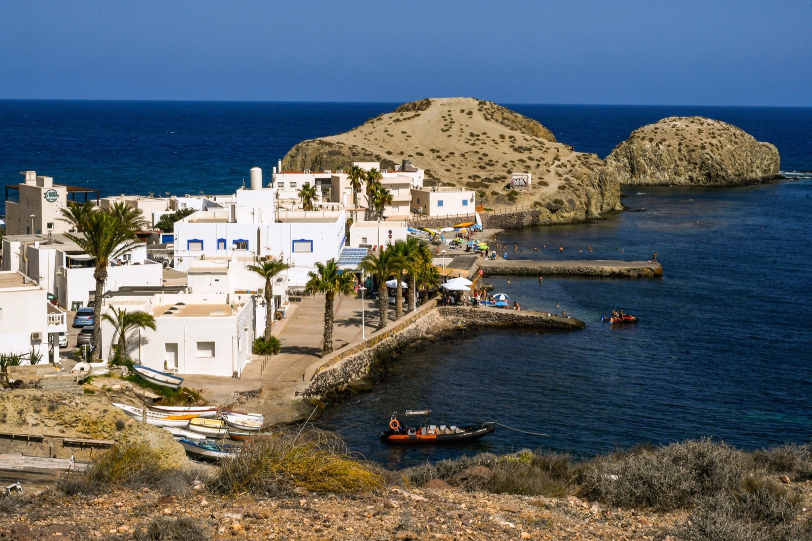
Cabo de Gata Boat Trips and Kayaking: Where to Go, What You See and the Rules at Sea
The best way to see the cliffs and coves of Cabo de Gata is from the water: by boat trip or sailboat from the harbours at San José and Carboneras, by kayak along the shore, or by the short boat from Las Negras beach, which reaches Cala San Pedro in 10 to 15 minutes. Snorkelling and swimming need no permission anywhere in the marine reserve, but the sea here is protected: anchoring is not permitted in the marine reserve except in emergencies, inside the integral reserve zones boats must stay below ten knots, and in summer kayaks may not gather in groups of more than 5 along the park’s coast. This guide explains where boats and kayaks leave from, what you see on each stretch of coast, how to choose between the options, and the rules that keep the sea as clear as it is.
Why go out on the water
Its 63 km of cliffs form the best-preserved coastline of the Spanish Mediterranean, and much of it has no road. The volcanic Sierra del Cabo de Gata falls to the sea in jagged 100-metre cliffs, cut by gullies into small coves and beaches, and many of those coves can be reached only on foot over steep paths or from the sea.
There is also more to see below the waterline than above it. Only 5 percent of the volcanic complex rises above the water; the other 95 percent lies below the sea. The marine reserve covers about 12,000 hectares, or 120 km², and reaches down to 60 m. From a boat or kayak you see lava flows, columns of volcanic rock and sea caves at water level, and you can stop to snorkel over the Posidonia meadows.
The options compared
| Option | Where from | Best for | Things to know |
|---|---|---|---|
| Boat trip | San José, Carboneras | Seeing a long stretch of coast without effort | Runs only in suitable sea conditions |
| Sailboat | Carboneras | A slower half day with a swim | A family-friendly sailboat from Carboneras to Los Muertos beach and Agua Amarga, with a snorkelling stop in a cove |
| Guided kayak outing | Several villages | Active visitors; reaching coves at water level | Groups limited along the coast in summer |
| Boat to Cala San Pedro | Las Negras beach | Getting to a cove with no road | 10 to 15 minutes each way |
| Your own kayak or paddleboard | Sheltered beaches | Experienced paddlers | Same rules as everyone else; watch the wind |
| Scuba diving | With a dive business | Certified divers | Needs a permit in the reserve |
For what is running on your dates, with live prices and cancellation terms, see the tours page.
Where boats and kayaks leave from
San José
San José, the largest village on the park’s coast, has the most services and a marina built in 1985. San José’s bay has a fine sandy beach more than a kilometre long, with the marina at one end linked to the Plaza de Génova by a seafront promenade with a market every afternoon. It is the natural base for boat trips along the southern coast towards Genoveses, Mónsul and the cape, and it is the easiest harbour to reach by public transport: Autocares Bernardo buses run from Almería’s intermodal station to San José; the fare is €3.10.
La Isleta del Moro
La Isleta del Moro is a natural anchorage still used by its inhabitants, and its fishing tradition is alive; fresh fish is eaten on terraces facing the view. Níjar’s tourism directory lists diving businesses at La Isleta del Moro, and the coast either side, with the fossil dune of Los Escullos to the south and Cala de los Toros to the north, is good for kayaking on calm days.
Las Negras
Las Negras sits below the Cerro Negro; few cars pass through its streets, and boats are drawn up on its beach. It is the starting point for Cala San Pedro: boats from Las Negras beach reach Cala San Pedro in 10 to 15 minutes. Las Negras is reached on the AL-3106 from Campohermoso or Rodalquilar.
Carboneras and Agua Amarga
Carboneras, just outside the north-east corner of the park, is the base for trips to Los Muertos and the coves towards Agua Amarga. Autocares Frahermar runs a regular bus between Carboneras and Almería that takes about an hour, and Almería airport is about 60 km from Carboneras. Agua Amarga is a quiet fishing hamlet of fewer than 300 inhabitants who have always lived from the sea.
What you see from the sea
The south: San José to the cape
West of San José the coast opens into the bay of Genoveses, more than a kilometre long, closed to the south by the Morrón de los Genoveses. Beyond it is Mónsul, where the rocks are tongues of lava that reached the sea and were eroded by wind and water; a huge rock stands in the middle of the beach, and Steven Spielberg filmed scenes of Indiana Jones and the Last Crusade there. Then come Cala de la Media Luna and Cala Carbón, which is bounded to the south by Punta Redonda, with andesite rocks in columns, and the cliffs below the Vela Blanca watchtower.
At the very tip is the lighthouse, built in 1863, and the Mermaid Reef, whose rocks are old volcanic chimneys, dark from the material they erupted. The waters around the reef are a favourite with divers. Sailors here face strong currents, such as the Oran current, and reefs such as La Laja, which sank many vessels, so this stretch is for calm days and experienced skippers.
The middle: Los Escullos to Rodalquilar
North-east of San José the coast is wilder. Los Escullos is a tiny white village with the Castillo de San Felipe, built in 1771 to defend and watch the coast, and a fossil dune of strange shapes; then come La Isleta del Moro and its islet, Cala de los Toros at the foot of a palm-filled gully, and the high cliffs below the Mirador de La Amatista, up to 200 metres high. Further on, El Playazo is overlooked by the Castillo de San Ramón, a coastal battery for four cannon, and the Torre de los Lobos stands at 281 m above the sea, crowned by the Faro de la Polacra.
The north-east: Las Negras to Carboneras
This is the most popular stretch for boat trips and the one with the most coves you cannot drive to.
- Cala de San Pedro: beyond the Cerro Negro, reached only by boat or on foot; it has a ruined castle-battery and a natural freshwater spring. The beach is 250 metres of fine white sand with a gradual entry into the water.
- Cala del Plomo: a wild, rugged cove near Agua Amarga.
- Cala de Enmedio: 150 metres of golden sand and clear water between two sea-eroded limestone formations, reached on land only on foot.
- Agua Amarga and its ore dock: on the hill above the village are the ruins of the old loading dock where ore from the Lucainena de las Torres mines was shipped, until 1942.
- Mesa Roldán: its flat top is a fossil coral reef that grew on the dome about 6 million years ago, when it was under water.
- Los Muertos: a long beach below the cliffs between Agua Amarga and Carboneras, far from any village, with no services.
Cala San Pedro by boat
Cala San Pedro is the classic boat trip of the park. The walk in from Las Negras takes about two hours, and even from the San Pedro car park it is still about 2 km along a narrow path near cliffs, so most people take the boat at least one way. Cala San Pedro has a natural freshwater spring and a small community that lives there all year.
Go for the day, and take everything you need. Camping is prohibited there as elsewhere in the park: in 2020 a local association reported people pitching tents at San Pedro although free camping in the park is completely prohibited by the PORN, and it also reported boats anchored less than 200 m from the shore at San Pedro.
Los Muertos from the sea
Los Muertos is one of the most photographed beaches of the park, and one of the hardest to reach on foot: the path from the information point is about 700 metres with a steep drop, and the descent is not advisable for children, older people or anyone with reduced mobility. A boat trip shows you the beach from the water, but current rules prohibit landing boat passengers directly on Los Muertos beach. Plan to swim from the boat or at a snorkelling stop, not to step ashore.
The shore shelves steeply, so you are soon out of your depth, and swimming is dangerous in a strong levante (east) wind.
Kayaking
Kayaking suits this coast well: you can paddle close under the cliffs, into small coves and alongside the rocks where the fish gather. A few rules and practical points:
- Group size in summer. Over the same period as the beach access rules (in 2026, from 20 June to 27 September), kayaks, canoes and similar unpowered craft may not gather in groups of more than 5 along the park’s coast. Above that limit of 5 kayaks or canoes, permission from the regional delegation is needed. Guided outings therefore run in small groups.
- Choose the sheltered side. The two winds to know are the levante from the east and the poniente from the west. On a poniente day, pick coves sheltered from the west: Cala del Cuervo near Las Negras is sheltered from the westerly poniente, and Playa del Peñón Blanco at La Isleta is well sheltered from it too.
- Go early. Mornings are usually calmer and cooler, and the coves are quieter.
- Do not land at Los Muertos from the water. The landing ban at Los Muertos applies to boat passengers; respect it with a kayak too.
- Respect the integral reserve zones. In these zones only expressly permitted scientific work may take place; they include the waters around the Morrón de Genoveses and off Cabo de Gata itself, as well as Loma Pelada point.
A guided outing is the sensible choice if you have not paddled at sea before: the guide knows the wind, the safe landings and the snorkelling spots.
Snorkelling from a boat or kayak
Snorkelling is the reason many people take to the water here. In just a metre of water you can see several fish species; the richest marine life is at 5 to 10 metres, and Posidonia meadows can be seen from 15 metres deep. Species include grouper, sea bass, sea bream, scorpionfish, red mullet, cuttlefish, squid and octopus.
- Snorkelling and swimming need no permission anywhere in the reserve.
- Spearfishing and jigging are prohibited throughout the reserve.
- Collecting or removing any organism, or part of one, living or dead, is prohibited, including shells and sea urchins.
- Touch nothing and keep your fins off the seagrass.
The volcanoes, flamingos and snorkelling guide covers the best snorkelling spots from the shore.
Diving
Scuba diving is possible but regulated. Recreational scuba diving needs a permit, and night dives and dives from the shore are prohibited. The permit comes from the Government Sub-delegation in Almería or the park offices, and in practice most visitors dive with a local dive business, which holds the permits. Diving boats moor at designated points rather than anchoring.
The rules at sea
| Rule | Source |
|---|---|
| Free navigation, but below ten knots inside the integral reserve zones | State order regulating the marine reserve |
| Anchoring not permitted in the marine reserve except in emergencies | State order regulating the marine reserve |
| Snorkelling and swimming allowed without a permit | State order regulating the marine reserve |
| Recreational fishing only from a boat, with a permit, outside the integral zones | State order regulating the marine reserve |
| All fishing prohibited in the park’s inner waters | Park plan, 2008 |
| Boats over 75 tonnes may not anchor; smaller boats only in designated anchoring zones, except in bad weather | Park plan, 2008 |
| Motorised watercraft prohibited except at urban beaches, in buoyed zones | Park plan, 2008 |
| No more than 5 kayaks or canoes together along the coast in the summer period | Junta de Andalucía, 2026 |
| No landing of boat passengers on Los Muertos beach | Current rules |
The order behind most of these is Orden ARM/1744/2011, the state order that regulates the marine reserve; the park’s own plan was approved by Decree 37/2008. The park rules guide puts the sea rules alongside the rules on land.
When to go out
The sea is at its most inviting from June to September, and the calmest conditions are usually in the morning. The two winds to watch are the levante from the east and the poniente from the west; a strong wind of either can cancel trips, so keep a spare day. Check the forecast on the site’s weather page before you book, and read the cancellation terms on each product. The best time to visit guide goes through the months.
Outside summer, check that trips are running on your dates; the sea is still clear and the coves are empty, and the trade-off is cooler water.
What to bring
- Sun protection: hat, sunglasses, a long-sleeved top and water-resistant sun cream. There is no shade on the water.
- Water and a snack: most coves have no bars, and Los Muertos has no services.
- Swimming and snorkelling kit: many trips include a mask, but check what is provided.
- A dry bag for your phone and keys, especially in a kayak.
- Water shoes: the volcanic rocks are sharp, and some coves are pebbly.
Frequently asked questions
Can you take a boat to Cala San Pedro?
Yes. Boats from Las Negras beach reach Cala San Pedro in 10 to 15 minutes; the alternative is a walk of about two hours from Las Negras.
Can boats land at Los Muertos beach?
No. Current rules prohibit landing boat passengers directly on Los Muertos beach; you reach it on foot from the car park.
Do I need a permit to snorkel in Cabo de Gata?
No. Snorkelling and swimming need no permission anywhere in the reserve. Spearfishing is prohibited, and scuba diving needs a permit.
Can I rent a jet ski in Cabo de Gata?
Motorised watercraft are prohibited in the park except at urban beaches, in zones buoyed for it.
Can I kayak on my own?
Yes, if you are experienced and the sea is calm, but in the summer period kayaks may not gather in groups of more than 5, and the rules on reserve zones and landings apply to everyone.