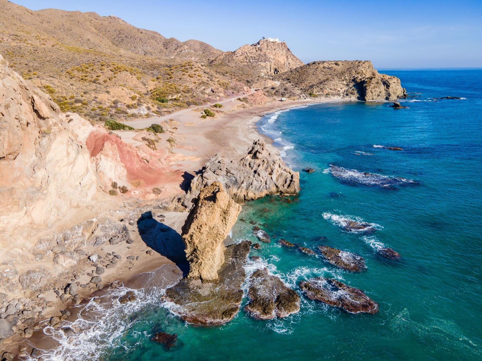
Cabo de Gata Viewpoints: Las Sirenas, Vela Blanca, La Amatista and the Best Sunrise Spots
The best viewpoints in Cabo de Gata are the Mirador de las Sirenas beside the lighthouse, for the reef of volcanic chimneys and the sunrise; the Mirador de la Vela Blanca, on a saddle with views both west to the lighthouse and east over Mónsul and Genoveses; the Mirador de La Amatista on the road from La Isleta to Rodalquilar, over cliffs up to 200 metres high; and the Torre de los Lobos, which at 281 m is one of the highest points in the park, with 360-degree views. Níjar’s tourism office numbers its viewpoints from M1, at the Atalaya de Níjar, to M12, Las Sirenas, and most can be reached by car with a short walk. This guide takes them from south to north, explains how to reach each one, and suggests which to visit at sunrise and which at sunset.
The viewpoints at a glance
| Viewpoint | Area | What you see | Best light |
|---|---|---|---|
| Las Sirenas | Cabo de Gata lighthouse | The Mermaid Reef, the lighthouse, open sea | Sunrise |
| Vela Blanca | Between the lighthouse and Mónsul | Both sides of the cape | Sunrise and sunset |
| Josefina Huertas | Above San José | Genoveses beach and the Morrón | Sunrise |
| La Isleta del Moro | Top of the village | The islet, Posidonia meadows, Los Frailes | Morning |
| La Amatista | Road from La Isleta to Rodalquilar | Cliffs, Los Frailes, the coast south | Any time |
| Torre de los Lobos | Above Rodalquilar | 360-degree views to Mesa Roldán | Any time |
| Cargadero de Mineral | Agua Amarga | The ore pier, Mesa Roldán, coves | Morning |
| Los Muertos | Between Agua Amarga and Carboneras | The whole beach from above | Morning |
| Atalaya de Níjar | Níjar town | The town, farmland, the park | Sunrise and sunset |
| Huebro | Sierra Alhamilla | The Campos de Níjar | Sunrise and sunset |
Planning a viewpoint drive
The viewpoints are spread over more than 60 km of coast, so you will not see them all in one go. The park divides naturally into three stretches: the cape and San José in the south-west, the middle coast from Los Escullos to Rodalquilar, and the north-east around Agua Amarga and Carboneras. Níjar town and Huebro sit inland. A day for each stretch is a comfortable pace; with an early start you can link two.
A few practical points apply everywhere:
- Parking is limited. Some viewpoints have small car parks; others only have roadside space. Arrive early in summer.
- Some last stretches are unsurfaced or closed to cars, notably Vela Blanca and the Torre de los Lobos.
- Flying drones for recreation is not allowed in the park, so photographs from the viewpoints have to be taken from the ground.
- There is little or no shade. Carry water and a hat, even for a short walk to a viewpoint.
The cape: Las Sirenas and the lighthouse
The Mirador de las Sirenas is beside the lighthouse, about 8 km south of San Miguel de Cabo de Gata on the AL-3115. The Cabo de Gata lighthouse was built in 1863 to warn passing ships off the coast, on top of the eighteenth-century San Francisco de Paula battery. Sailors here face strong currents, such as the Oran current, and reefs such as La Laja, which sank many vessels.
Below the viewpoint is the Mermaid Reef. The reef’s rocks are old volcanic chimneys, dark from the material they erupted, and the reef is probably named after the monk seals that once lived here, which old sailors could mistake for mermaids; there are none today. A short path leads down to a tiny cove with room for barely 4 or 5 towels at low tide.
There is a car park with about 50 spaces at the Las Sirenas viewpoint, with an information point beside it. The viewpoint faces the open sea and is recommended for sunrises over the Mediterranean. On the way you pass the salt flats, where flamingos are present all year round; there are two bird-watching hides, set well back from the birds, so bring binoculars.
Vela Blanca
The Vela Blanca viewpoint is on a saddle between the Cabo de Gata lighthouse and the Campillo de los Genoveses, with views both west and east. To the west you see Cala Raja, Punta Baja, the lighthouse and the Cerro de la Testa; to the east La Media Luna, Mónsul and Los Genoveses. Beside it stands the Vela Blanca watchtower, built to watch for Barbary pirates; it signalled to other towers with smoke.
It is recommended at sunrise and sunset for the reflections and colours, and because it looks both ways, the time of day matters less here than at most viewpoints: in the morning the light falls on the coves to the east, in the evening on the cliffs to the west.
Getting there
There are two ways up:
- From the lighthouse side: from the AL-3115 the ALP-822 leads up to the Vela Blanca viewpoint. The last part may be a dirt road; if it is in poor condition, leave the car in a designated area and walk up.
- On foot from Mónsul: the Vela Blanca trail is a linear walk of 5.9 km, about 2h 30m, graded low difficulty, from the Casa del Mónsul past Cala de la Media Luna and Cala Carbón. Walking on past the barrier at the end of the track, you can climb the Vela Blanca hill for a view over the coves.
In summer, motor access to the beaches west of San José is regulated (in 2026 from 20 June to 27 September), so the Mónsul approach is best done on foot, by bike or by the shuttle from San José. The hiking guide has the full route.
San José: Josefina Huertas and the Morrón de los Genoveses
The Mirador Josefina Huertas above San José is named after a woman who stopped a hotel being built on the spot. It looks over Genoveses beach and the Morrón de los Genoveses and is a place to watch the sun rise over the sea. To reach it, go through San José by Calle Cuevas to Calle Aljibe and follow the signs.
For a wider view of the same bay, climb the Morrón itself. The Morrón de los Genoveses hill closes the south of the bay and gives a view over the beach, the Campillo del Genovés and San José; the volcanic dome rises 74 m over the beach, at the end of the 2.3 km Los Genoveses trail. Genoveses fills the whole bay, more than a kilometre long, so from either point you see the full curve of sand.
La Isleta del Moro
The La Isleta del Moro viewpoint, at the highest point of the village, has 25 parking spaces. From it you see the islet that shelters the boats, the dark bands of Posidonia meadows and the Los Frailes ridge with the weather radar on top. La Isleta del Moro is named after a small islet off its coast where the pirate Mohamed Arraez is said to have hidden, and it is still a working anchorage, with fresh fish eaten on terraces facing the view.
Combine the viewpoint with the short coastal walk from Los Escullos: 1.6 km, about 40 minutes, with a maximum climb of only 19 m.
La Amatista
The Mirador de La Amatista looks over sheer cliffs up to 200 metres high and the Cerro de los Frailes. It is on the road from La Isleta towards Rodalquilar, past the turning for Cala de los Toros, and there is roadside parking near it.
It is named after an outcrop of amethyst quartz nearby, close to the Las Niñas mine where gold was first found in the area; gold was discovered at Rodalquilar in 1883, in a lead mine called Las Niñas, setting off a gold rush. The Cerro de los Frailes, the highest hill in the area, is 493 metres high, and its two volcanic domes frame the view to the south-west.
This is the easiest of the great viewpoints: you park, walk a few steps, and the whole southern coast opens up. It works at any time of day, though the cliffs are at their best in the afternoon light.
Torre de los Lobos
At 281 m the Torre de los Lobos viewpoint is one of the highest points in the park, with 360-degree views. From the tower you see Rodalquilar and its mines, Los Frailes, La Amatista, Cala de San Pedro and Mesa Roldán. A lighthouse, the Faro de la Polacra, was placed on the Torre de los Lobos in 1991; it is the highest lighthouse in Spain and the Mediterranean.
A gate stops cars on the road up, so you walk the last stretch to the tower. The turning is off the road from Rodalquilar towards Las Negras; leave the car before the gate, where a path also leads down towards Cala del Carnaje.
Nearby, the La Molata trail from El Playazo gives a lower but closer view of the same coast: from La Molata you can see Cala de San Pedro and Mesa Roldán. It is 1.5 km, about 1 hour, medium difficulty, and starts near the Castillo de San Ramón, a coastal battery for four cannon at the north end of El Playazo, finished in 1768.
Agua Amarga: the Cargadero de Mineral
The Cargadero de Mineral viewpoint at Agua Amarga looks over the old ore pier, Mesa Roldán and the El Plomo and Cala de Enmedio beaches. On the hill above Agua Amarga are the ruins of the old loading dock where ore from the Lucainena de las Torres mines was shipped; the dock worked from the late nineteenth century until 1942, when the last ore ship, the Bartolo, sailed.
For the viewpoint, cross the village to Calle Niño, where there is a car park, then follow Calle Ferrocarril Minero.
Los Muertos and Mesa Roldán
Heading from Agua Amarga towards Carboneras, past the Mesa Roldán tower and lighthouse, lies Los Muertos beach. Before the walk down to Los Muertos, the Mirador de Los Muertos viewpoint shows the whole panorama: a long curve of pale shingle and turquoise water below the volcanic cliffs.
Mesa Roldán itself is a landmark from almost every viewpoint on the north-east coast. Its flat top is a fossil coral reef that grew on the dome about 6 million years ago, when it was under water. The volcanoes guide explains its geology.
In summer the Los Muertos car park charges €6 for cars, from 09:00 to 21:00, and spaces are limited, so arrive early if you also want to swim.
Inland: Níjar town and Huebro
Níjar town has its own cluster of viewpoints, useful on a day when the coast is windy or crowded.
- Atalaya de Níjar: reached on foot up the town’s streets, following signs. A tower was built there in the sixteenth century against pirate raids on the coast.
- Atalaya–Cabo de Gata: looks out over the park to the sea and has picnic tables.
- Atalaya–Huebro: from this viewpoint the colours of the landscape change most at sunrise and sunset.
- Cerrico Redondo: at the entrance to Níjar town, easy to reach by car or on foot.
- Plaza de Huebro: Huebro is reached from Níjar on the Camino de Huebro, a narrow, winding road up into the sierra. From the nearby hamlet of Huebro you can see the whole of the Campos de Níjar.
The Huebro viewpoint stands 700 metres above sea level in the foothills of the Sierra Alhamilla, the highest of all the viewpoints in this guide.
Viewpoints you walk to
Some of the best views in the park have no road at all.
- Los Frailes: the tallest volcano has two domes, the higher nearly 500 metres above sea level, and a trail to the summit. On a clear winter morning it shows the whole park, from the salt flats to Mesa Roldán.
- The Torre de Cala Higuera: near the end of the Loma Pelada trail is a 224 m hill topped by a watchtower built in 1767, with views over San José bay and Genoveses.
- The Requena valley: the Requena trail climbs past abandoned farmhouses with views over the Rodalquilar valley, with a maximum climb of 416 m.
- The Las Negras to Agua Amarga coast: the long coastal trail passes above Cala San Pedro and Cala del Plomo, with views of coves you otherwise see only from a boat.
The hiking guide gives the distance, time and car park for each.
Photography tips
- Arrive before sunrise at the east-facing viewpoints; the best colour lasts only a short time.
- Use a long lens at the salt flats: the hides are set well back from the birds.
- Look down as well as out: from Las Sirenas and La Isleta the clear water shows the Posidonia meadows as dark bands below the surface.
- Keep to the paths at the cliff-top viewpoints; the edges are loose volcanic rock.
Sunrise or sunset?
Most of the park’s coast faces south and east, so sunrise is the better bet for sea views.
- For sunrise: Las Sirenas, Josefina Huertas, Vela Blanca and La Isleta del Moro.
- For sunset: Vela Blanca, looking west towards the lighthouse, and the Atalaya de Níjar and Huebro viewpoints inland.
- At any time: La Amatista and the Torre de los Lobos, which look along the coast rather than into the sun.
For the times of sunrise and sunset and the cloud forecast for your dates, check the site’s weather page before you set out.
Seeing the coast from the sea
The viewpoints show you the cliffs from above; a boat or kayak shows you the coves at their foot, many of them unreachable by road. A sailboat from Carboneras, for example, runs to Los Muertos beach and Agua Amarga with a snorkelling stop in a cove. The boat trips and kayaking guide compares the options, and you can book them on the tours page.
A viewpoint day from San José
- Dawn: Mirador Josefina Huertas, above San José, for the sunrise over Genoveses.
- Morning: drive round by the salt flats to the lighthouse and Las Sirenas, then up to Vela Blanca.
- Midday: swim at Genoveses or Mónsul (in summer, by shuttle or on foot).
- Afternoon: north to La Isleta del Moro and La Amatista.
- Late afternoon: the Torre de los Lobos above Rodalquilar, then down to El Playazo.
Frequently asked questions
What is the most famous viewpoint in Cabo de Gata?
The Mirador de las Sirenas beside the lighthouse, over the Mermaid Reef and its volcanic chimneys.
Where is the best sunset in Cabo de Gata?
Vela Blanca, on its saddle above the lighthouse, with views west and east; inland, the Atalaya de Níjar and Huebro.
Can I drive to the Vela Blanca viewpoint?
From the lighthouse side, yes, on the ALP-822, but the last part may be a dirt road; if it is in poor condition, leave the car and walk up.
Can I fly a drone at the viewpoints?
No. Flying drones for recreation is not allowed in the park.
What is the highest viewpoint on the coast?
The Torre de los Lobos, at 281 m, crowned by the Faro de la Polacra, the highest lighthouse in Spain and the Mediterranean.