Hiking in Cabo de Gata: The Best Trails, Distances, Times and Where to Park
Cabo de Gata is one of the best places on Spain’s Mediterranean coast to walk, as long as you choose the season and the trail with care. The Níjar tourism office publishes a set of waymarked trails across the park, most of them short and graded low or medium difficulty: the easiest, such as Los Genoveses (2.3 km, about 1h 30m) and Los Escullos to La Isleta del Moro (1.6 km, about 40 minutes), suit almost anyone, while the longest coastal route, from Las Negras via Cala del Plomo to Agua Amarga, is 11.1 km one way, takes about 4h 30m and is graded medium to high. The rest of this guide sets out the trails by area, with their distances, times, climbs and car parks, and explains how to walk them safely in one of the driest corners of Europe.
How walking works in the park
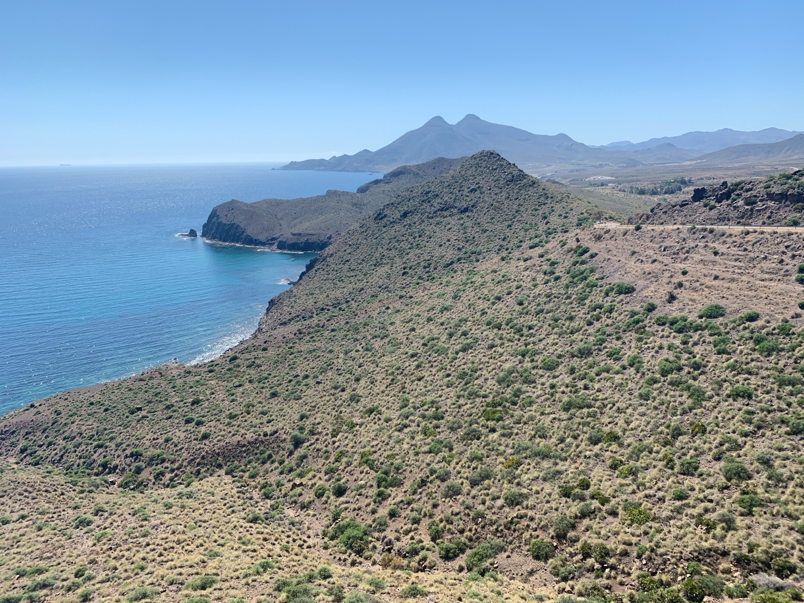
The park is a volcanic sierra that falls straight into the sea, cut by dry gullies into small coves. Most trails follow either the coast, linking coves and watchtowers, or the inland valleys around Rodalquilar, where old gold mines, farmhouses and threshing floors are scattered across the hills. The highest point, the Cerro de los Frailes, is only 493 metres, so the climbing is modest; what makes walking here demanding is the sun, the lack of shade and the lack of water.
The trail sheets published by the Níjar tourism office give each route a distance, a typical time, a difficulty grade (low, medium or medium to high), the maximum climb and the type of surface, which ranges from wide tracks to narrow paths near cliffs. The times are walking times without long stops; on the coastal routes most people add time for swimming.
A few points shape every walk here:
- Ten months of every year are considered arid, and there are almost no springs. Carry all the water you need.
- Many routes are linear. Vela Blanca, Los Genoveses, Loma Pelada, Requena and the Las Negras to Agua Amarga route all end somewhere other than where they start, so plan to walk back, arrange a lift, or turn round halfway.
- Driving off the permitted tracks is prohibited, and so is riding bikes or horses off them. On foot, stay on the marked paths: the park is restoring dunes and slopes trampled by people walking off the trails.
- The regional environment department advises carrying water, sun protection and suitable clothing and footwear, and checking the weather forecast before setting out.
The trails at a glance
| Trail | Area | Distance | Time | Difficulty |
|---|---|---|---|---|
| Los Genoveses | San José | 2.3 km, linear | about 1h 30m | Low |
| Vela Blanca | West of San José | 5.9 km, linear | about 2h 30m | Low |
| Sendero Azul | Pozo de los Frailes to San José | 2.6 km | about 1h 30m | Low |
| Caldera de Majada Redonda | Inland, Las Presillas | 2.8 km | about 1 hour | Low |
| Los Escullos to El Pozo de los Frailes | Los Escullos | 4.7 km | about 1h 50m | Low |
| Los Escullos to La Isleta del Moro | Los Escullos | 1.6 km | about 40 minutes | Low |
| Requena | Rodalquilar valley | 7.4 km, linear | about 3 hours | Medium |
| Cerro del Cinto, short | Rodalquilar | 4.4 km, circuit | about 1h 30m | Low |
| Cerro del Cinto, long | Rodalquilar | 10 km, circuit | about 4 hours | Medium |
| Cortijo del Fraile, Montano and Hornillo | Inland | 7.7 km, circuit | about 3 hours | Low |
| La Molata | El Playazo to Cala del Cuervo | 1.5 km | about 1 hour | Medium |
| Las Negras via Cala del Plomo to Agua Amarga | North-east coast | 11.1 km, one way | about 4h 30m | Medium to high |
| Lucainena greenway | Near Agua Amarga | 8.2 km, circuit | about 2h 40m | Low |
| Molinos de Huebro | Níjar town | 2.55 km | about 1h 30m | Medium |
Around San José: Los Genoveses and Vela Blanca
The coast west of San José holds the park’s most famous beaches, and two trails connect them.
Los Genoveses
The Los Genoveses trail is a linear walk of 2.3 km, about 1h 30m, graded low difficulty. It starts at the Genoveses windmill, restored in 2007, reached by a turning about 300 metres along the dirt track towards Mónsul. There are about 20 parking spaces near the start, 150 metres from the information panel.
The path crosses the flat Campillo del Genovés, a farming plain of cereal fields, and comes down to the great bay of Genoveses, more than a kilometre long and backed by small dunes. On the way you pass Civil War bunkers on the beach and a fossil dune at its southern end. The walk finishes at the Morrón de los Genoveses, a volcanic dome that rises 74 m over the beach; from the top you look back across the bay, the Campillo and San José.
This is the best first walk in the park: short, almost flat, and ending at a beach where you can swim. With children it works well, although there is no shade at all.
Vela Blanca
The Vela Blanca trail is a linear walk of 5.9 km, about 2h 30m, graded low difficulty, with a maximum climb of 120 m and a highest point of 136 m. It starts at the Casa del Mónsul, about 4.5 km along the track from San José past Genoveses, where there is a car park with about 50 spaces.
From Mónsul the path runs along the edge of the volcanic sierra past Cala de la Media Luna and Cala Carbón, which is bounded to the south by Punta Redonda, with andesite rocks in columns, then climbs through the Barranco de la Parra, with its fan palms, to the Vela Blanca viewpoint. At the highest point is the Vela Blanca watchtower, built to watch for Barbary pirates; it signalled to other towers with smoke. From the saddle you see both sides of the cape: the lighthouse to the west, and Mónsul and Genoveses to the east.
In summer, check the access rules before you drive: motor access to the beaches west of San José is regulated, and in 2026 the regulation ran from 20 June to 27 September, with a single €6 fee per vehicle and a barrier that closes early when the car parks are full. A shuttle bus from San José drops you at the beach access points, and walking or cycling in is free. The guide to getting to Cabo de Gata explains the system in full.
The Sendero Azul and Los Escullos
Sendero Azul
The Sendero Azul César Díaz Torres, between El Pozo de los Frailes and San José, is 2.6 km, about 1h 30m, low difficulty, on a path rated good for accessibility. It runs beside the road through old farmland under the twin volcanic domes of Los Frailes. The Cortijo del Sotillo on this route appears in Sergio Leone’s A Fistful of Dollars: Clint Eastwood rides up to its entrance in the first scene. At El Pozo de los Frailes the animal-powered waterwheel, wash house and trough date from the early twentieth century and were used until the 1980s.
It is an easy walk for anyone staying in San José, the largest village on the park’s coast, and a good choice for a cooler morning.
Los Escullos to El Pozo de los Frailes
The Los Escullos to El Pozo de los Frailes trail is 4.7 km, about 1h 50m, low difficulty, on a track through rolling volcanic hills with views of the sea. It starts near the Castillo de San Felipe at Los Escullos, which was built in 1771 to defend and watch the coast and restored in 1991. Along the way are old farmhouses, an animal-powered waterwheel with its pond, and a restored windmill.
Los Escullos to La Isleta del Moro
The Los Escullos to La Isleta del Moro trail is 1.6 km, about 40 minutes, low difficulty, and its maximum climb is only 19 m. It begins at Playa del Arco, beside the fossil dune of Los Escullos, and follows the shore to the fishing village of La Isleta. From La Isleta, steps lead to Playa del Peñón Blanco, well sheltered from the westerly poniente and named after the white rock in its middle.
Climbing the rock outcrops of the Los Escullos fossil dune is prohibited, and the Junta is fencing off the Los Escullos fossil dune and the Mónsul dune. Walk past them, not over them.
Loma Pelada
The Loma Pelada trail starts at the Castillo de San Felipe in Los Escullos and ends at Cala Higuera, near San José. It is the wildest stretch of the southern coast, with the Cerro de los Frailes, the highest hill in the area at 493 metres, rising inland. The trail passes old cobblestone quarries and the ruins of the Loma Pelada Civil Guard barracks near Cala Tomate. Near the end of the trail is a 224 m hill topped by a watchtower built in 1767, with views over San José bay and Genoveses. There are about 20 parking spaces at the start of the trail and more at Cala Higuera, where it ends.
Linking the Escullos and Loma Pelada trails gives a fine one-way day between Los Escullos and San José if you can leave a car at each end.
Inland volcanoes: Majada Redonda and Requena
Caldera de Majada Redonda
The Caldera de Majada Redonda trail is 2.8 km, about 1 hour, low difficulty. The Majada Redonda caldera, a huge circular volcanic depression, is the park’s main geological attraction, and this short walk along a dry riverbed takes you into it, past dry-stone terraces, an old stone well and a ruined farmhouse with a large threshing floor. The trail starts in a dry riverbed, so the park advises leaving cars in the 25-space car park in Las Presillas. In spring the albaida shrub flowers along the route; beekeepers value it for its mild honey.
Requena
The Requena trail is linear, 7.4 km, about 3 hours, medium difficulty, with a maximum climb of 416 m, the biggest of any trail in this guide. It starts in the Barranco del Negro, about 600 metres before the turning for La Isleta del Moro on the AL-4200 south from Rodalquilar. Near the start, Cala de los Toros is an oasis of palms, tamarisks and pines whose gully opens onto a cove of pebbles and sand. The trail then climbs past rock hollows that hold rainwater for birds, a relict pocket of pines and abandoned farmhouses with views over the Rodalquilar valley, and ends near the Cortijo del Fraile.
Los Frailes
Los Frailes, the tallest volcano, has two domes, the higher nearly 500 metres above sea level, and a trail to the summit. It is the classic viewpoint walk of the south, best on a clear winter or spring morning.
Rodalquilar: gold mines and the Cortijo del Fraile
Rodalquilar, the old gold-mining village at the heart of the park, is the best base for walking inland. Gold mines worked the hills around Rodalquilar from 1940 to 1966, and the trails here wind between mine entrances, processing plants and empty miners’ settlements.
Cerro del Cinto
The short Cerro del Cinto trail at Rodalquilar is a 4.4 km circuit of about 1h 30m, graded low difficulty, and the Cerro del Cinto long circuit is 10 km, about 4 hours, medium difficulty, with a maximum climb of 235 m. Both start about 25 metres from the park’s administrative office and exhibition room in Rodalquilar, where there is parking for more than 20 vehicles.
The long circuit begins at the Denver plant, built at the top of the mining village in 1956 and closed in 1966. Its refining hall is now the Casa de los Volcanes, an interpretation centre on the park’s geology with a small mining museum. Further on, the San Diego mining settlement belonged to Minas de Rodalquilar SA, which worked most successfully from 1929 until the Civil War stopped production in 1936.
Cortijo del Fraile, Montano and Hornillo
The trail from the Cortijo del Fraile past the Montano and Hornillo farmhouses is a 7.7 km circuit of about three hours, graded low difficulty. There is a car park with about 20 spaces beside the Cortijo del Fraile. On the night of 22 July 1928 the Cortijo del Fraile was the scene of the crime that inspired Lorca’s play Blood Wedding, and Sergio Leone later filmed For a Few Dollars More and The Good, the Bad and the Ugly there. The farmhouse, a listed Bien de Interés Cultural, is awaiting restoration as a future cultural centre; see it from outside. In 1989 and 1990 a company extracted gold nearby by cyanide leaching, which was soon abandoned as unprofitable.
A newer route for walkers and cyclists links Los Albaricoques, the Cortijo del Fraile and Rodalquilar; its first stretch is paved and also open to vehicles. Los Albaricoques was the setting for many European westerns.
The north-east coast: La Molata, Cala San Pedro and Agua Amarga
La Molata
The La Molata trail is 1.5 km, about 1 hour, medium difficulty. El Playazo is reached by a concrete track of about two kilometres that leaves the AL-4200 1 km from Rodalquilar towards Las Negras. The trail starts near the Castillo de San Ramón, a coastal battery for four cannon at the north end of El Playazo, finished in 1768, and crosses the cliffs of a fossil reef to Cala del Cuervo, a cove of grey sand. From La Molata you can see Cala de San Pedro and Mesa Roldán. On the way in you pass the Torre de los Alumbres, built in 1510 to defend the alum mines opposite.
Las Negras to Cala San Pedro
Cala de San Pedro, beyond the Cerro Negro, can only be reached by boat or on foot, a walk of about two hours; it has a ruined castle-battery and a natural freshwater spring. Even from the San Pedro car park it is still about 2 km along a narrow path near cliffs. Boats from Las Negras beach reach Cala San Pedro in 10 to 15 minutes, so a popular plan is to walk one way and take the boat back. Go for the day: free camping in the park is prohibited, and the beaches guide covers the cove itself.
Las Negras via Cala del Plomo to Agua Amarga
The trail from Las Negras via Cala del Plomo to Agua Amarga is 11.1 km one way, takes about 4h 30m and is graded medium to high, with a maximum climb of 249 m. It leaves Las Negras on a track north to the Cortijada del Estanquillo, half a kilometre away, where there is a car park with about 20 spaces; there are more at Cala del Plomo and Agua Amarga. The route passes above Cala San Pedro, crosses volcanic headlands to Cala del Plomo, and reaches Cala de Enmedio, with 150 metres of golden sand between two sea-eroded limestone formations, before dropping to Agua Amarga.
This is the finest coastal walk in the park and the most serious: long, exposed, with steep sections and no water. Start early, carry plenty to drink, and arrange transport back.
The Lucainena greenway
The greenway trail from Lucainena to Agua Amarga is an 8.2 km circuit of about 2h 40m, graded low difficulty, with a maximum climb of 108 m. It follows the cutting of the old mining railway, past cave houses and farmhouses, to the ruins of the loading dock at Agua Amarga, where iron from the Lucainena mines was loaded onto ships bound for the blast furnaces.
Níjar town and Huebro
Inland, the town of Níjar sits in the foothills of the Sierra Alhamilla. The Molinos–Huebro trail, partly on the GR-140, is 2.55 km, about 1h 30m, medium difficulty, with a maximum climb of 263 m. Along the way are the remains of more than 22 water mills; the last stopped working in the 1970s. The Huebro viewpoint stands 700 metres above sea level, and from the nearby hamlet of Huebro you can see the whole of the Campos de Níjar. It is the coolest walk in the area on a warm day.
When to walk
The best months for walking are from autumn to spring. AEMET’s normals for Almería Airport give an average high of 16.9 °C in January, 21.4 °C in April and 24.5 °C in October, against 30.5 °C in July and 31.0 °C in August. Rain falls mainly in autumn and winter and is very rare in summer, but single-day downpours can exceed 200 mm, more than the average for a whole year; dry gullies can flood quickly, so do not start a gully walk if heavy rain is forecast.
In July and August, walk only short trails, and only at first light; the coastal paths have no shade, and the rocks hold the heat. The guide to the best time to visit covers each month, and the site’s weather page has the live forecast for the park.
What to carry
- Water: more than you think, as there is nowhere to fill up on most trails.
- Sun protection: hat, sunglasses and sun cream, even in winter.
- Proper footwear: walking shoes with grip; the volcanic rock is sharp and loose on descents. Sandals are not enough for Vela Blanca, Requena or the Las Negras to Agua Amarga route.
- Swimming kit on coastal routes, and snorkelling gear if you have it.
- A charged phone and an offline map: signal is patchy in the gullies.
- Food: villages are far apart, and there is nowhere to buy drinks at Mónsul.
Rules on the trail
- Lighting fires is prohibited in the park.
- Flying drones for recreation is not allowed in the park.
- Camping, and parking vehicles fitted as dwellings, outside tourist campsites and camping areas between sunset and sunrise, is prohibited.
- During the bathing season, from 1 June to 30 September, domestic animals may not enter bathing waters and bathing areas, which affects walks that end at a beach.
- Organised convoys of four or more vehicles need prior permission from the regional environment department.
The park rules guide explains all of these in detail.
Combining walks with the sea
Several trails pair well with time on the water. The Vela Blanca walk ends above coves that you can also see from a boat or kayak, and the Las Negras routes start at the beach where the boats to Cala San Pedro leave. If you would rather see the cliffs without the climb, the boat trips and kayaking guide explains the ways onto the water, and the tours page lists what is running on your dates.
Frequently asked questions
What is the best hike in Cabo de Gata?
For a first visit, Vela Blanca: 5.9 km, about 2h 30m, low difficulty, past Mónsul, Media Luna and Cala Carbón to a viewpoint over both sides of the cape. For a full day, the 11.1 km route from Las Negras to Agua Amarga.
Are the trails waymarked?
Yes. The Níjar tourism office publishes trail sheets with distances, times, grades and car parks, and the trails have information panels at the start.
Can I hike in Cabo de Gata in summer?
Only short routes, very early in the morning. July and August average highs above 30 °C, and the coastal paths have no shade or water.
Is there an easy walk for families?
Los Genoveses (2.3 km) and Los Escullos to La Isleta del Moro (1.6 km, with a maximum climb of only 19 m) both suit children, and both end by the sea.